Ötztal Alps as a 3D Relief
Handmade in the Bavarian Alps.
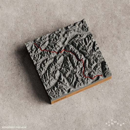
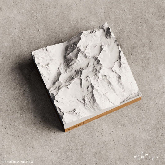
The Ötztal Alps between Tyrol and South Tyrol hold the Wildspitze, the highest mountain in North Tyrol. This collection includes the Wildspitze and the Texel group as single-color mountain reliefs, plus the Wildspitze normal route, the Similaun, the Timmelsjoch and the E5 long-distance trail from Oberstdorf to Merano as Track.
-
Mountain Model Track | Alps Crossing | E5 - Oberstdorf - Merano
通常価格 $182.00 CADから通常価格単価 あたり -
Mountain Model Classic | Wildspitze
通常価格 $129.00 CADから通常価格単価 あたり -
Mountain Model Classic | Texelgruppe | Meran
通常価格 $129.00 CADから通常価格単価 あたり -
Mountain Model Track | Timmelsjoch
通常価格 $156.00 CADから通常価格単価 あたり -
Mountain Model Track | Similaun via Similaunhütte
通常価格 $156.00 CADから通常価格単価 あたり -
Mountain Model Track | Wildspitze normal route
通常価格 $156.00 CADから通常価格単価 あたり




The Ötztal Alps as a 3D relief map
The Upper Inn Valley, the Ötztaler Ache, the Passeier Valley and the Vinschgau bound one of the largest mountain groups of the Eastern Alps. It is considered the largest mountain mass in the Eastern Alps and is heavily glaciated at high altitude. Glaciers here are called Ferner, above all the Gepatschferner at almost 17 km². From the north, the Kaunertal, Pitztal and Ötztal reach deep into the massif, and higher up the Ötztal branches into the Venter Tal and the Gurgler Tal.
Peaks of the Ötztal Alps
At 3,768 m, the Wildspitze is the highest summit of the group and, after the Grossglockner, the second highest mountain in Austria. Its south summit was first reached in 1848 by Leander Klotz from Rofen and an unknown farmer. The main Alpine ridge with the national border runs over the Schnalskamm, which includes the Weißkugel at 3,738 m and the Similaun at 3,599 m. Between the Similaun and the Fineilspitze lies the Tisenjoch: this is where the man from the Tisenjoch, known as Ötzi, was found in September 1991.
Huts and crossings in the Ötztal Alps
At 3,019 m, the Similaunhütte stands on the Niederjoch, not far from the border on Italian territory. From there, the normal route as a high alpine tour leads over the Niederjochferner and the west ridge to the Similaun. On the Wildspitze, the normal route leads from the firn basin north of the Mitterkarjoch over the southwest ridge to the south summit, reachable for example from Vent via the Breslauer Hütte. In South Tyrol, the Meraner Höhenweg, about 90 km long, circles the Texel group, whose highest elevation is the Roteck at 3,337 m. The Timmelsjoch at 2,474 m is the only drivable crossing of the main Alpine ridge between the Reschen Pass and the Brenner Pass and separates the Ötztal Alps from the Stubai Alps.
Reliefs from the Ötztal Alps
The E5 also crosses the group: on the Geigenkamm between the Pitztal and the Ötztal, just past the Braunschweiger Hütte, it reaches almost 3,000 meters, and the route continues to Italy over the Timmelsjoch or, in a variant, via the Similaunhütte. The single-color Classic reliefs show only the terrain, the Track reliefs also show the route as a raised line.
Your own area of the Ötztal Alps
Kaunergrat, Gurgler Tal or Schnalstal missing from the range? In the live 3D configurator you set the area freely. With your own GPX file it becomes a relief with your own route. The base comes in oak or stone pine, an engraving can be added, and it is built by hand in the Bavarian Alps, with the terrain from real elevation data.
The Ötztal Alps as a gift
Wildspitze, Similaun, Meraner Höhenweg: a mountain relief of these suits high alpine climbers after their summit day and long-distance hikers after the E5. If the destination is not yet fixed, there is always the gift card.
Which peaks of the Ötztal Alps are available ready-made as a 3D relief?
The Wildspitze is available in a single color as Classic and with the normal route as Track, the Similaun as Track via the Similaunhütte. There are also the Texel group as Classic and two routes with a raised line: the pass road over the Timmelsjoch and the E5 from Oberstdorf to Merano.
Can I choose my own area in the Ötztal Alps, for example the Gurgler Tal?
Yes. You search for the Kaunergrat, Gurgler Tal or Schnalstal by name in the live 3D configurator and move the area freely. Before you order, you see the relief in the preview from all sides. Five sizes are available, from 10 × 10 cm to 28 × 28 cm.
Can my high alpine tour on the Wildspitze go on the relief as a line?
Yes, in the custom Relief Track. You upload the recording as a GPX file or link it from Strava, Komoot or Garmin; the route is then modeled as a raised 3D line in red or white. You can also send the track by email after ordering.
Are the Ötztal Alps available in color with rock and snow?
Yes, as Relief Natural. It colors forest, meadow, rock, water and snow true to nature, and you set the snow line yourself. You also choose summer or winter mode, for an area around the Wildspitze or the Similaun as well as for the Ötztal.
More collections near the Ötztal Alps
To the east lie the Stubai Alps, to the south the Ortler Alps. The E5 passes through the Allgäu Alps before, and pass roads are collected on the Alpine passes page.
Your own area?
Design any summit and any tour yourself, live in 3D.