Karwendel as a 3D Relief
Handmade in the Bavarian Alps.
Innsbruck's Nordkette, the route of the Karwendelmarsch and the Achensee on the eastern edge: the Karwendel is available here as a 3D relief, in a single color, with a raised route or as a TrailMap. Other corners of the range, such as the Hinterautal, you put together yourself in the live 3D configurator.
-
Mountain Model Classic | Achensee
通常価格 $129.00 CADから通常価格単価 あたり -
Mountain Model Classic | Innsbruck, Nordkette
通常価格 $129.00 CADから通常価格単価 あたり -
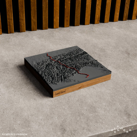
Mountain Model Track | Alps Crossing | Munich - Venice
通常価格 $238.00 CADから通常価格単価 あたり -
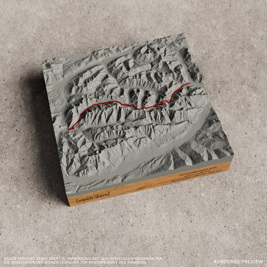
TrailMap | Karwendelmarsch
通常価格 $279.00 CAD通常価格単価 あたり -
Mountain Model Track | Karwendelmarsch
通常価格 $182.00 CADから通常価格単価 あたり -
TrailMap | Karwendelmarsch | 2026
通常価格 $226.00 CADから通常価格単価 あたり -
Mountain Model Track | Karwendelmarsch | 2026
通常価格 $200.00 CADから通常価格単価 あたり -
Mountain Model Track | Alps Crossing | Munich - Lake Garda
通常価格 $238.00 CADから通常価格単価 あたり





The Karwendel: four chains from west to east
Around 80 percent of the Karwendel lies in Tyrol and the smaller part in Bavaria; the mountain group of the Northern Limestone Alps measures about 45 kilometers from east to west and just under 30 kilometers from north to south. Four large chains run from west to east: the Northern Karwendel chain, the Hinterautal-Vomper chain, the Gleirsch-Halltal chain and the Inn Valley chain. Hermann von Barth, who opened up the range, started the tradition of naming them after the valleys that bound them to the south. The north sides have faces up to 1,000 meters high, the gentler south sides wide cirques. The Isar rises in the Hinterautal.
Birkkarspitze, Nordkette and Achensee
At 2,749 m, the Birkkarspitze is the highest elevation of the Karwendel, located in the Hinterautal-Vomper chain. Hermann von Barth made its first ascent on July 6, 1870; in the same summer he climbed 88 summits solo. Because of its location north of Innsbruck, the Inn Valley chain is generally called the Nordkette; its highest summit is the Kleiner Solstein at 2,637 m, and the Nordkettenbahn cable car runs via the Seegrube to the Hafelekar at 2,269 m, from where it is a few minutes to the Hafelekarspitze (2,334 m). In the east, the range is bounded by the Achensee, up to 133 m deep and the largest lake in Tyrol. Only one public road leads into the heart of the Karwendel, to the Großer Ahornboden.
Karwendelmarsch and Traumpfad
On the Karwendelmarsch, participants walk and run 52 kilometers from Scharnitz through the Karwendel to Pertisau on the Achensee, gaining 2,300 meters of elevation; the shorter distance ends after 35 kilometers in the Eng. The Traumpfad from Munich to Venice, first described in a book by Ludwig Graßler in 1977, also crosses the range: from Hinterriß via the Kleiner Ahornboden to the Karwendelhaus. The following day over the Schlauchkarsattel to the Hallerangerhaus is considered the most challenging stage of the whole route and is therefore called the queen stage.
Karwendel reliefs in our range
- Classic, single color: Achensee and Innsbruck with the Nordkette.
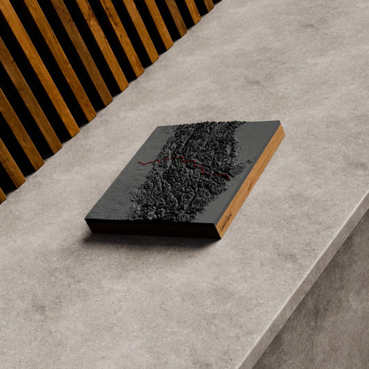
- Track with a raised route: Karwendelmarsch, Karwendelmarsch 2026 and the Alpine crossing from Munich to Venice and from Munich to Lake Garda.
- Runners choose the TrailMap, our flat map relief: Karwendelmarsch and Karwendelmarsch 2026.
A Karwendel cut to your own measure
For the Eng, the Hinterautal or the Kleiner Solstein, you choose the area in the live 3D configurator. Upload your recording of the Karwendelmarsch or the Traumpfad as a GPX file to the custom Track relief, where it stands as a raised line in the terrain. We make every mountain relief by hand in the Bavarian Alps and mount it on oak or stone pine; an engraving is added if you want one.
A Karwendel relief delights finishers of the Karwendelmarsch, people in Innsbruck with a view of the Nordkette and hikers who have crossed the Schlauchkarsattel. Would you rather leave the area open? Then the gift card is the right choice.
Which Karwendel motifs are available ready-made as a relief?
In a single color as Classic, the Achensee and Innsbruck with the Nordkette are available. We offer the Karwendelmarsch as a Track relief with a raised route and as a TrailMap, each also in the 2026 edition. There are also two Alpine crossings as Track: from Munich to Venice and from Munich to Lake Garda.
Can I order my recording of the Karwendelmarsch as a relief?
Yes. In the custom Relief Track you upload your GPX file or add a link from Strava, Komoot or Garmin. The route from Scharnitz to Pertisau then stands as a raised 3D line in the terrain, in red or white. Up to two tracks can be combined on one relief.
Can I choose my own area in the Karwendel, for example the Eng?
Yes. In the live 3D configurator you enter a place such as the Eng, the Hinterautal or the Großer Ahornboden and move the area as you like. The preview shows the relief from all sides before you order. It is made in the Bavarian Alps and mounted on an oak or stone pine base.
Is the Karwendel also available in color and with snow?
Yes, as Relief Natural with true-to-nature coloring of forest, meadow, rock, water and snow. You set the snow line yourself, and summer or winter mode as well. You choose the area, for example with the Achensee or the Nordkette, in the configurator.
More collections
Continue with Wetterstein Mountains and Zugspitze, gifts for hikers, gifts for trail runners and all TrailMaps.
Your own area?
Design any summit and any tour yourself, live in 3D.