Mont Blanc Massif as a 3D Relief
Handmade in the Bavarian Alps.
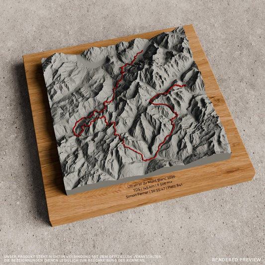
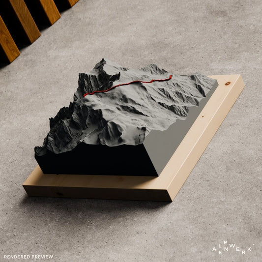
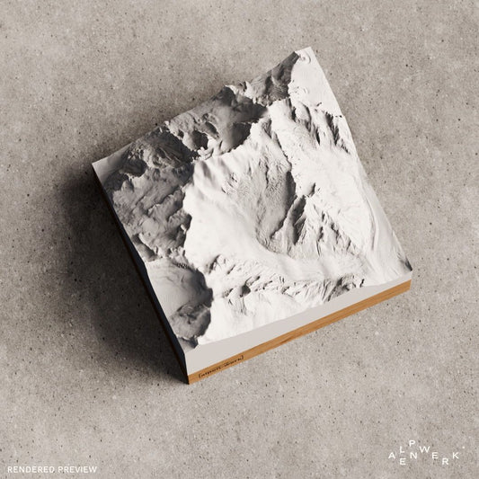
The Mont Blanc massif holds the highest mountain in the Alps. We offer Mont Blanc and the Grandes Jorasses as a single-color Relief Classic, and the normal route, the Tour du Mont Blanc and the Ultratrail du Mont Blanc as Track with the route as a raised line.
-
Mountain Model Classic | Mont Blanc
通常価格 $129.00 CADから通常価格単価 あたり -
Mountain Model Track | Ultratrail du Mont Blanc | 2026
通常価格 $200.00 CADから通常価格単価 あたり -
Mountain Model Track | Mont Blanc normal route
通常価格 $156.00 CADから通常価格単価 あたり -
Mountain Model Track | Ultratrail du Mont Blanc | 2025
通常価格 $191.00 CADから通常価格単価 あたり -
Mountain Model Classic | Grandes Jorasses
通常価格 $129.00 CADから通常価格単価 あたり -
Mountain Model Track | Tour du Mont Blanc
通常価格 $156.00 CADから通常価格単価 あたり -
Mountain Model Track | Tour du Mont Blanc | Bike
通常価格 $156.00 CADから通常価格単価 あたり







The Mont Blanc massif where three countries meet
Where France, Italy and Switzerland meet lies the Mont Blanc group, spread across the Haute-Savoie department, the Aosta Valley and the canton of Valais. Its higher part is called the Mont Blanc massif. It is bounded by the Arve valley with Chamonix, the Val Montjoie, the two Val Ferret valleys in Switzerland and Italy and, southwest of Courmayeur, the Val Veny. Apart from Mont Blanc, relatively few summits exceed the four-thousand-meter mark, but the relative difference in elevation to the valleys is the greatest in the Alps.
Mont Blanc, Grandes Jorasses and Aiguille du Midi
Translated, Mont Blanc means “white mountain”, in Italian Monte Bianco; at 4,807 m it is the highest mountain in the Alps. In August 1786, Jacques Balmat and Michel-Gabriel Paccard, who had set out from Chamonix, were the first to reach the summit. The highest point of the Grandes Jorasses is the Pointe Walker at 4,208 m. Its almost vertical north face rises 1,000 m above the Leschaux Glacier and, together with the north faces of the Matterhorn and the Eiger, was one of the “three last problems of the Alps” until it was first climbed in 1935. The Aiguille du Midi (3,842 m) has been reachable by cable car from Chamonix since 1955, and the Mer de Glace, at around 12 km, is the largest glacier in France.
Normal route and Tour du Mont Blanc
The most frequently climbed route today is the normal route via the Aiguille du Goûter and the Dôme du Goûter. A common starting point is the Nid d’Aigle at 2,386 m, the terminus of the Tramway du Mont Blanc rack railway; one of the bases is the Refuge du Goûter (3,835 m), the highest staffed mountain hut in France. The Tour du Mont Blanc circles the group through France, Italy and Switzerland, over roughly 170 km with about 10,000 meters of elevation gain, usually counterclockwise in seven to ten days. Since 2003, the Ultratrail du Mont Blanc has been run from Chamonix, largely along this route.
The Mont Blanc massif as a ready-made relief
We offer Mont Blanc and the Grandes Jorasses in a single color as Relief Classic. Track reliefs, on which the route runs as a raised line, are available for the Mont Blanc normal route, the Tour du Mont Blanc together with its bike version, and the Ultratrail du Mont Blanc in the 2025 and 2026 editions.
Your own route on Mont Blanc
Chamonix, Courmayeur or the Mer de Glace: you decide on the area in the live 3D configurator. If you recorded the normal route or a race around the massif, the GPX file becomes a Track relief with your line. The terrain comes from real elevation data, and we build the relief and mount it on oak or stone pine in our workshop in the Bavarian Alps.
Mont Blanc as a gift
The normal route relief suits mountaineers after their summit day, the Tour du Mont Blanc suits long-distance hikers, and one of the two Ultratrail editions suits finishers. The finish time or the summit date can be engraved in the base. If the route is still unclear, the recipient chooses it later with the gift card.
Which Mont Blanc reliefs are available ready-made?
Mont Blanc and the Grandes Jorasses are available in a single color as Relief Classic. As Track with a raised line, we offer the normal route up Mont Blanc, the Tour du Mont Blanc on foot and as a bike version, and the running route around the massif in the 2025 and 2026 editions.
Can I choose Chamonix or the Mer de Glace as my own area?
Yes. In the live 3D configurator you search for Chamonix, Courmayeur or the Mer de Glace by name and move the area as you like. The preview shows the relief from all sides before you order, and it is mounted on oak or stone pine.
Will my own Tour du Mont Blanc fit on a relief?
Yes. You place the area in the configurator so that the whole loop fits on it; the recording goes into the custom Relief Track as a GPX file or as a link from Strava, Komoot or Garmin. The route is modeled as a raised 3D line in red or white.
Is Mont Blanc also available in color with snow?
Yes, as Relief Natural. It colors forest, meadow, rock, water and snow true to nature; you set the snow line yourself and choose between summer and winter mode. You choose the area around Mont Blanc in the configurator.
More collections
From Chamonix, the Haute Route leads to Zermatt in the Valais Alps. More running routes are under TrailMap and gifts for trail runners, long-distance trails under gifts for hikers.
Your own area?
Design any summit and any tour yourself, live in 3D.