


TrailMap Munich Marathon - 2024
Solid oak with laser-engraved contour lines, your route as a raised line in the color of your choice on top, checkpoint names on request. Cartography for the wall.
Configure your TrailMap
Your summit moment, forever in your hands.
30cm x 30cm
True to scale next to an A4 sheet, selected: . 30 × 30 cm oak, larger than an A4 sheet, approx. 2 cm thick. Version: engraved contour lines.
White stands out with the most contrast on the oiled oak.
Every TrailMap is a handmade one-of-a-kind piece, engraved exactly as you want it. And if something still isn't right, we'll find a solution. That's a promise.
47.6646° N · 12.6463° E · Workshop in the Bavarian Alps
Not sure about the size or map area? Write to us. We'll help you personally.
When will your TrailMap arrive?
Duties and import taxes included for the US, UK, Switzerland, Liechtenstein, Norway, Andorra, Australia and New Zealand.
What you get.
Engraved and raised
The contour lines are laser-engraved into the oiled oak, and the route sits on top as a raised line in the color of your choice: flatter and more cartographic than Mountain Model Track.
Accurate to the millimeter
Exact LiDAR elevation data from the state surveying offices, measured by laser, accurate to 0.5 m.
Checkpoints & names
Place names along the route and finisher engraving, typical for event editions.
Solid oak
30 × 30 cm, oiled, PEFC, with a hanger for the wall.
Planning an event edition?
Finisher trophies with event badge, checkpoint engraving and serial numbering, volume discount from 10 pieces, logo engraving and branding included.
About this TrailMap
Munich Marathon 2024, the 38th edition on October 13, 2024, with start and finish in the Olympiapark. This TrailMap shows the marathon route on the city's street network, laser engraved in solid oak, the course as a raised 3D line on top.
42.195 km through Munich
In 2024 the start and finish were at the Hans-Jochen-Vogel-Platz in the Olympiapark, because the Olympic Stadium was being renovated. From there the route led along the Leopoldstraße and past the Siegestor into the Englischer Garten, on past the Art Nouveau villas in eastern Munich to the Gasteig and back into the center with the Bavarian State Opera, Marienplatz and Odeonsplatz, before returning to the Olympiapark via Leopoldstraße and Franz-Joseph-Straße. The half marathon started at the Chinesischer Turm in the Englischer Garten and ran the second half of the marathon route. The first marathon through Munich's streets was run at the 1972 Olympic Games, today's event goes back to a revival in 2000 and takes place on the second Sunday of October.
The 2024 route
- Marathon: 42.195 km, start and finish at the Hans-Jochen-Vogel-Platz in the Olympiapark
- Size: 30 x 30 cm
- Track color: white, light gray, charcoal or black
What is on the map
This plate carries Munich's street network around the route, laser engraved in solid oak. The marathon route sits on it as a raised, 3D-printed line. Engraved below: Munich Marathon 2024, 42.195 km as well as name, time and placing, exactly as you enter them when ordering. Handmade in the Bavarian Alps.
For finishers and their crews
Leopoldstraße, Englischer Garten, Marienplatz and the finish in the Olympiapark: a memento of the Munich Marathon 2024 for finishers and for the people who stood along the route.
alpen-werk is not affiliated with the official organizer.
Absolut Top verarbeitet,Super Kundenservice,habe schon das 3 Modell bei mir zu hause💯👍🏻Kann ich nu jedem zu 100% weiterempfehlen.Vielen herzlichen dank Stephan und dem ganzen Team❤️💯💪👌bis zur nächsten Besellung
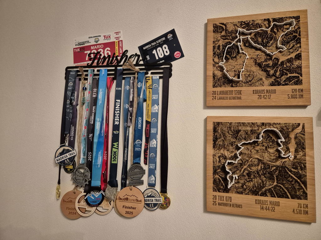
Sehr netter Kontakt vorab und ganz tolle und detailreiche Umsetzung der Trailmap. Ein außergewöhnliches Geschenk, in meinem Fall, für ein unvergessliches Abenteuer meines Mannes. Er war total begeistert und ich auch - da haben sich 2 total gefreut. Gern wieder.
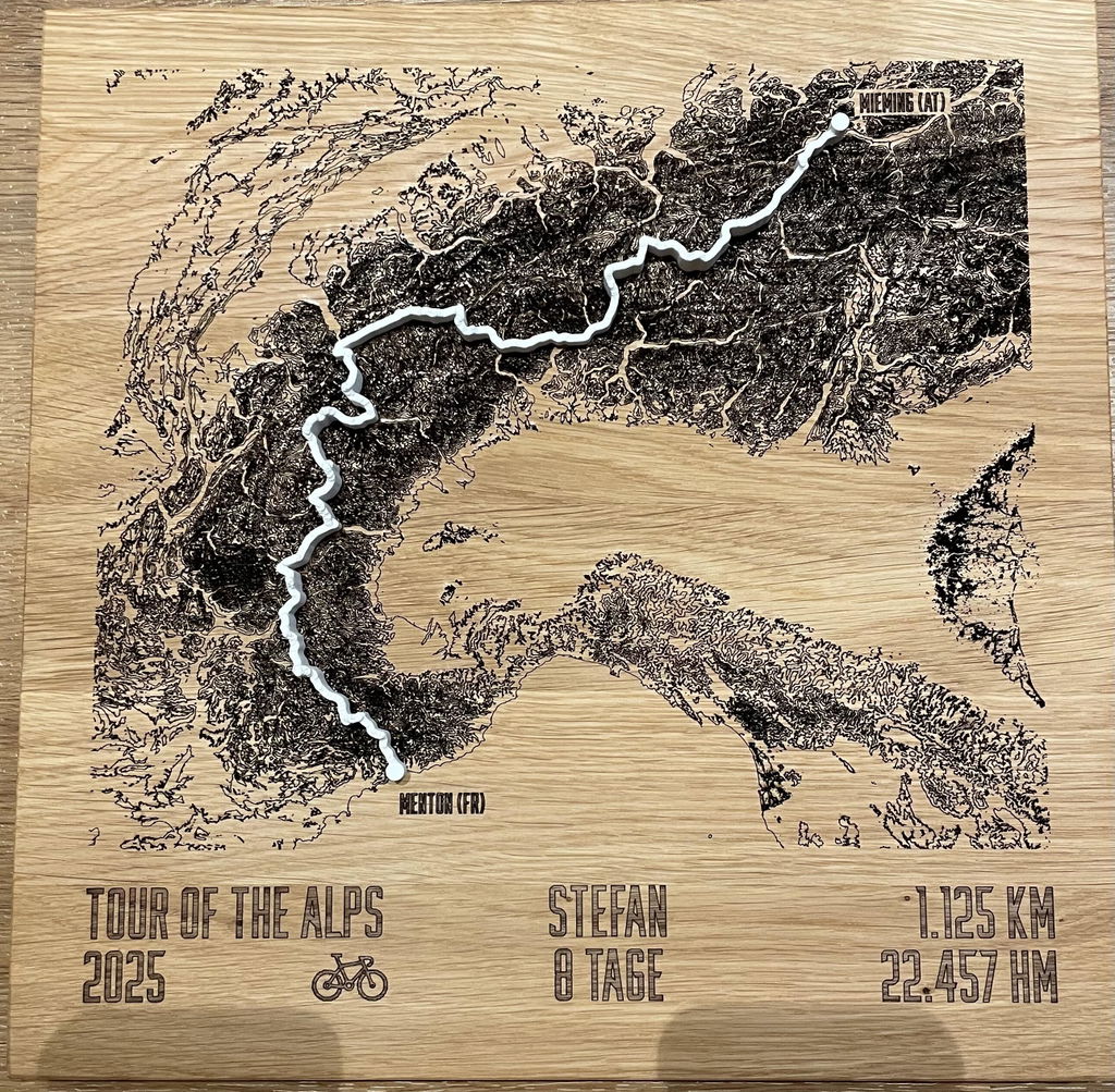
An ein interessantes Abenteuer in Frankreich.
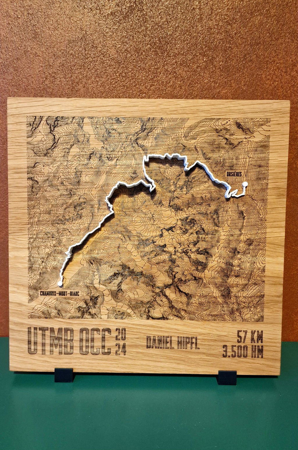
Absolut wunderbar, ich war wirklich überrascht wie gut das alles aussieht gerne wieder
Alles wie beschrieben und wie erwartet, also perfekt zur eine Erinnerung an persönliche „Erfolge“
Meine individuelle TrailMap ist wirklich großartig geworden. Die Verarbeitung ist sehr sehr schön.
Ich hab mich richtig gefreut, als ich es ausgepackt habe und wusste, dass ich das meinem Lieblingsmenschen schenken darf.
Danke!
Erwartungen absolut erfüllt, Geschenk wurde freudig angenommen, sehr rasche Produktion
Gracias,Alpen Werk por este excelente trabajo, el nivel de detalle es impresionante
Das Ding ist echt super geworden :)
Super gemacht, schaut toll aus.
Perfektes Erinnerungsstück.
Die Schrift ist relativ schwach eingebrannt, könnte noch etwas stärker sein.
Sehr cooles Teil. Hochwertig und eine wunderschöne Erinnerung an den Trailrun. Absolute Empfehlung.
Die Auftragsabwicklung war TOP! Ich habe vom Ausland/Insel,… Urlaub die Daten hochgeladen, auch kein Problem. Ich habe eine „riesen Freude“ damit 😊😊😊
Bin mehr als zufrieden super schön verarbeitet.sehr detailgetreu superschnelle lieferung freu mich schon auf meinen nächsten lauf lass mir sicher wieder eins anfertigen vielen fank nochmals von mir gibts 10 von 10 Punkten
Es hat alles einwandfrei geklappt.
WOW richtig toll! Es ist nicht nur qualitativ hochwertig sondern sieht auch extrem speziell schön aus! Echt starke Arbeit!!
Richtig schöne sorgfältige Verarbeitung!
gerne wieder
Schon die Idee hat mich überzeugt, die Bilder der Beispiele sind schon gut, wenn man dann seine eigene Strecke mit Höhenprofil auf hochwertigen Holz in der Hand hält, einfach klasse. Auch die Bearbeitungszeit und Rückmeldung sehr gut. Insgesamt sehr zufrieden.
Ein wunderschönes Stück Erinnerung an ein tolles Abenteuer. So wird die Wanderung von Freiburg nach Verona und die Strecke noch greifbarer. Danke Stephan.
Gesamter Bestellprozess absolut top!
Super freundlicher Kontakt und kompetente Beratung.
Produkt qualitativ hochwertig und sehr gut verarbeitet.
Ein tolles, wertiges Erinnerungsstück !!!
[prima Service: individualisierbar]
Questions & answers.
01What is the difference to Mountain Model Track?
Mountain Model Track models your tour as a raised 3D line on the printed model. The TrailMap engraves the contour lines flat into solid oak and places your route on top as a raised line in the color of your choice: a cartographic look, ideal for events and checkpoint names.
02What does LiDAR mean, and why does it make your model so accurate?
LiDAR is airborne laser surveying: an aircraft scans the terrain with millions of laser points, and the official state surveying offices turn them into an elevation model with a resolution of up to 0.5 m. This is exactly the data your model is based on, which is why every ridge, every gully and every summit sits exactly where it really is. Freely available satellite elevation data only resolves to 30 m, which is 60 times coarser. On top of that, we prepare every dataset for 3D printing in a dedicated quality step: cleaned, smoothed, with sharp rock edges and without digital artifacts.
03Which routes work?
Any GPX route, from a trail run to a Transalp to your home loop. A Komoot link, your Strava login or a GPX file you upload yourself is all it takes.
04What can be engraved?
Route, contour lines, checkpoint names along the route, finisher name and time, and for event editions also the organizer's logo as a single-color engraving.
05How long does delivery take?
Standard: 3 to 8 business days production plus shipping 1 to 7 business days. Express: 2 to 4 business days plus express shipping 1 to 2 business days. For the US, UK, Switzerland, Liechtenstein, Norway, Andorra, Australia and New Zealand, customs duties and import taxes are included (DDP).
06Is there a volume discount for events?
Yes, from 10 pieces, with logo engraving and custom branding included. Commission models for clubs are possible too. Get in touch via the B2B inquiry.
07What if something isn't right?
Every TrailMap is made to order (no right of withdrawal under §312g of the German Civil Code). If something isn't right, we will find a solution. That's a promise.
Technical data.
- Line
- TrailMap · engraved oak, raised route
- Format
- 30 × 30 cm · Fixed price
- Version
- Engraved contour lines + route
- Track colors
- White · Light gray · Anthracite · Black
- Material
- Solid oak, oiled (PEFC)
- Mounting
- Hanger for the wall
- Elevation data
- LiDAR elevation data from the official state surveying offices, measured by laser, accurate to 0.5 m
- Precision
- More precise than models made from freely available elevation data