Bernina Range and Engadine as a 3D Relief
Handmade in the Bavarian Alps.
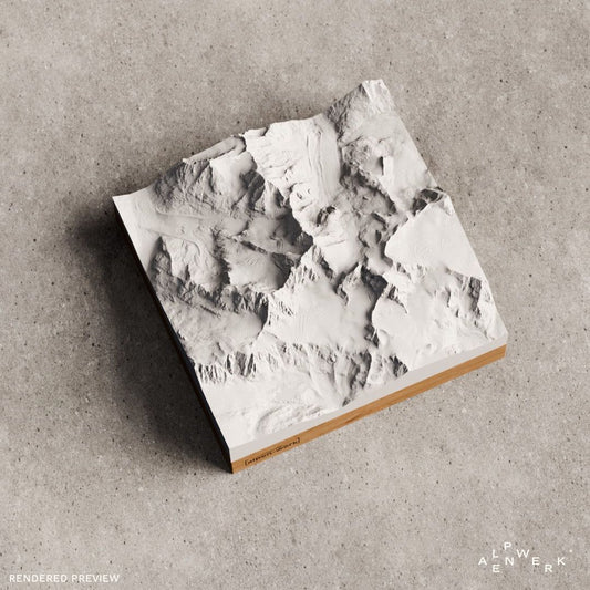
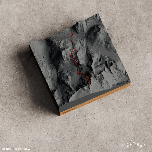
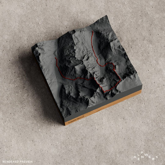
The Bernina Range and the Engadine as a relief: Piz Bernina in a single color as Classic, the Biancograt and the Piz Palü east ridge as Track with a raised line, and the Engadin Ultratrail as a flat TrailMap for runners.
-
Mountain Model Classic | Piz Bernina
通常価格 £59.00 GBPから通常価格単価 あたり -
TrailMap | EUT - Engadin Ultratrail | 2025
通常価格 £119.00 GBP通常価格単価 あたり -
Mountain Model Track | Piz Palü, East Ridge
通常価格 £59.00 GBPから通常価格単価 あたり -
Mountain Model Track | Piz Bernina, Biancograt
通常価格 £59.00 GBPから通常価格単価 あたり




Bernina Range and Upper Engadine
Usually just called the Bernina, the Bernina Range is a mountain group in the central Eastern Alps. It extends south of the Upper Engadine from the Muretto Pass to the Bernina Pass. Its main ridge is part of the main Alpine ridge and forms the watershed between the Inn and the Danube to the north and the Adda and the Po to the south; in the western and central sections, the border between Switzerland and Italy runs over the Bernina. The name is recorded in 1429 as the field name Barnyna; its meaning is unknown.
Piz Bernina, Piz Palü and Piz Roseg
At 4,048 m, Piz Bernina is the only four-thousander in the Eastern Alps and the highest mountain in Graubünden. Of its three summits, the middle one is the highest; the south summit, Spalla, reaches 4,018 m. Its north ridge, the Biancograt (Romansh Crast’ Alva), ends with its firn section at the north summit and is often called the most beautiful ice ridge in the Alps. On September 13, 1850, the surveyor Johann Wilhelm Coaz set out with Jon and Lorenz Ragut Tscharner for the first ascent; Coaz transferred the name Bernina to the summit. With its three summits and four hanging glaciers, Piz Palü (3,899 m) is considered one of the most beautiful glacier mountains anywhere, and Piz Roseg (3,935 m) stands above the Val Roseg.
Biancograt, east ridge and Morteratsch
The starting point for the Biancograt is the Chamanna da Tschierva (2,583 m) in the Val Roseg. The popular route follows the firn crest of the north ridge, with ice up to 50° and UIAA grade III at the transition to the summit. On Piz Palü, today's normal route starts at the Diavolezza, crosses the Pers Glacier to the shoulder of the east ridge and follows the partly exposed crest to the east summit and the main summit. On the north side of Piz Bernina lies the Morteratsch Glacier; together with the Pers Glacier, on which the north side of Piz Palü rests, it is the glacier with the largest volume in the Eastern Alps.
The Engadine
The Engadine is a high valley in the canton of Graubünden, more than 80 km long, forming the upper valley section of the Inn; it is divided into the Upper and Lower Engadine. The valley floor of the Upper Engadine at 1,600 to 1,800 m is shaped by the lakes of the Engadine lake plateau: Lake Sils, Lake Silvaplana, Lej da Champfèr and Lake St. Moritz. Over the Bernina Pass (2,235 m), the Engadine is connected with the Val Poschiavo and the Valtellina.
Bernina and Engadine as a ready-made relief
Piz Bernina is available as a single-color mountain relief in the Classic line. Two Track reliefs show ascents as a raised line: Piz Bernina via the Biancograt and Piz Palü via the east ridge. Runners will find the TrailMap of the Engadin Ultratrail 2025, a flat map relief of the course.
Your own tour in the Bernina
You put together another area, such as the lake plateau of the Upper Engadine or Piz Roseg, in the live 3D configurator. Your recorded high alpine tour, for example over the Biancograt, becomes a raised line as a GPX file in the Track relief. We build every Bernina model by hand in the Bavarian Alps from real elevation data.
The Bernina as a gift
The Biancograt relief is aimed at high alpine climbers, the Palü relief at everyone who has climbed up from the Diavolezza, and the TrailMap at finishers of the Engadin Ultratrail. Name and date are engraved; Classic and Track stand on oak or stone pine, the TrailMap on oak. As an alternative there is the gift card.
Which peaks of the Bernina Range are available as a relief?
Piz Bernina is available in a single color as Classic and via the Biancograt as Track with a raised route, and Piz Palü via the east ridge is also available as Track. For runners there is the TrailMap of the Engadin Ultratrail 2025.
Can I choose the Upper Engadine or Piz Roseg as my own area?
Yes. In the live 3D configurator you search for a place such as Lake Sils or Piz Roseg by name and move the area across the lake plateau or the peaks. Before you order, the preview shows the relief from all sides.
Can my high alpine tour in the Bernina go on the relief?
Yes, with the custom Relief Track. Upload the recording, for example of the ascent from the Diavolezza, as a GPX file or link it from Strava, Komoot or Garmin. The route is modeled as a raised 3D line in red or white and can also be sent by email after ordering.
More collections
After the Bernina, the Ortler group is the second highest mountain group in the Eastern Alps. Four-thousanders of the Western Alps are gathered on the pages Valais Alps and Mont Blanc massif; running routes as a flat map relief are in the TrailMap collection.
Your own area?
Design any summit and any tour yourself, live in 3D.