Dachstein as a 3D Relief
Handmade in the Bavarian Alps.
The Dachstein is the main summit of the Dachstein Mountains, and the border between Upper Austria and Styria runs over its highest point. This collection includes the Dachstein massif, Hoher Dachstein, Große Bischofsmütze and Grimming as mountain reliefs, plus the normal route over the glacier as Track.
-
Mountain Model Classic | Hoher Dachstein
Normal price From $219.00 NZDNormal priceBase price for -
Mountain Model Classic | Grimming - Steiermark
Normal price From $219.00 NZDNormal priceBase price for -
Mountain Model Classic | Dachsteinmassiv
Normal price From $219.00 NZDNormal priceBase price for -
Mountain Model Classic | Große Bischofsmütze
Normal price From $219.00 NZDNormal priceBase price for -
Mountain Model Track | Hoher Dachstein, normal route via the glacier
Normal price From $299.00 NZDNormal priceBase price for

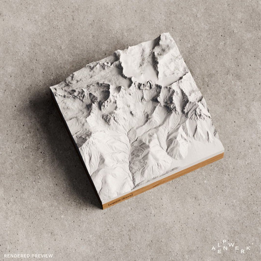

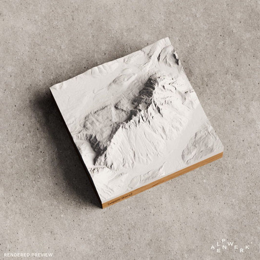


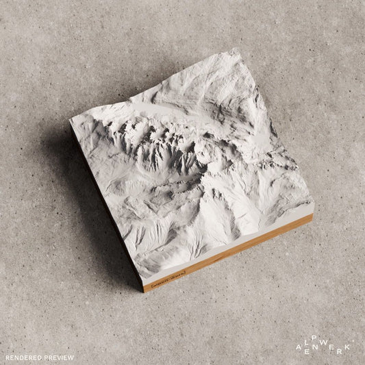


The Dachstein Mountains as a mountain relief
Three federal states share the Dachstein Mountains: Styria in the east and south, Salzburg in the west, Upper Austria in the center and north. They belong to the Northern Limestone Alps, are heavily karstified and consist mainly of Dachstein limestone. Here lies the easternmost and largest glacier group by area in the Northern Limestone Alps, and large caves run through the mountains, including the Hirlatz Cave with over 112 kilometers, the third longest cave in Austria. Since December 1997, most of the range together with the Inner Salzkammergut has been part of the UNESCO World Heritage Site Hallstatt-Dachstein/Salzkammergut Cultural Landscape.
Hoher Dachstein, Bischofsmütze and Grimming
The three highest elevations stand on the southern edge of the plateau: Hoher Dachstein at 2,995 m, Torstein at 2,948 m and Mitterspitz at 2,925 m, and their south faces reach around 1,000 meters in height. The first tourist ascent of the Hoher Dachstein was made on July 18, 1834 by Peter Karl Thurwieser, guided by the Gappmayr brothers from Filzmoos. In the Gosaukamm, along whose rocky ridge the border between Salzburg and Upper Austria runs, the Große Bischofsmütze at 2,458 m is the highest summit; together with the Kleine Bischofsmütze it forms a double summit. In a rockfall on September 22, 1993, it lost a 200 m high pillar. The eastern end point is the Grimming at 2,351 m: although a deep transverse valley separates it from the main massif, it counts as part of the Dachstein Mountains. It used to be called “Mons Styriae altissimus”, the highest mountain of Styria.
Simonyhütte, glacier and Trail 601
The Simonyhütte has stood at the foot of the Hallstatt Glacier since 1877. In 1843 Friedrich Simony built the world's first via ferrata on the Hoher Dachstein, the Randkluftsteig, and on January 14, 1847 he made the first winter ascent. From the Simonyhütte, the Schulter route and the Randkluft route lead over the Hallstatt Glacier to the summit. Trail 601 crosses the central massif and the Gosaukamm, from Hallstatt via the Simonyhütte, Steinerscharte, Adamekhütte, Hofpürglhütte and Gablonzer Hütte to Gosau.
Reliefs of the Dachstein
Design the Gosau lakes or the Krippenstein yourself
Gosau lakes, Hoher Krippenstein or the Dachstein south faces: the live 3D configurator frames the right area, and with a GPX file it becomes a relief with your own route. Oak or stone pine for the base, optional engraving: we take care of the rest in the Bavarian Alps, handmade from real elevation data.
The Dachstein as a gift
Randkluftsteig, Bischofsmütze, Grimming: the relief suits high alpine climbers after the glacier, climbers from the Gosaukamm and cross-country skiers from the Ramsau. If you don't know the name of their favorite mountain, the gift card helps.
Which Dachstein reliefs are available ready-made?
In a single color as Classic, the Dachstein massif, the Hoher Dachstein, the Große Bischofsmütze in the Gosaukamm and the Grimming are available. As Track with a raised line, we offer the normal route over the glacier to the Hoher Dachstein.
Can I order my own area around the Dachstein?
Yes. In the live 3D configurator you start with a place search, for example for the Gosau lakes, the Hoher Krippenstein or Hallstatt, and move the frame freely. The preview shows the relief from all sides before you order. It is made in the Bavarian Alps, as Base (desk version) or Wall (wall relief) on oak or stone pine.
Can I get my tour on Trail 601 as a relief?
Yes, in the custom Relief Track. The recording comes as a GPX file or as a link from Strava, Komoot or Garmin, and the route is modeled as a raised 3D line in red or white. If the track is not at hand when you order, you can send it by email later.
Is the Dachstein also available in color, with rock and snow?
Yes, as Relief Natural with true-to-nature coloring: forest, meadow, rock, water and snow. You set the snow line yourself, and there is a summer mode and a winter mode. For cross-country skiers from the Ramsau, winter mode is the natural choice.
More collections near the Dachstein
The Kaiser Mountains also belong to the Northern Limestone Alps, and the Berchtesgaden Alps go well with them. Glaciated summits of the Central Alps are in the Hohe Tauern collection, ideas for rope teams in gifts for mountaineers.
Your own area?
Design any summit and any tour yourself, live in 3D.